Lichades islets, from E
Mythic Origins – The Tragedy of Lichas (Ancient Greek Tradition)
The traditional name of the islands is deeply rooted in Greek mythology. According to the legend transmitted through Sophocles, Diodorus Siculus, and later writers, the islands were named after Lichas, the unfortunate servant of Heracles. It was Lichas who carried to the hero the fateful tunic soaked in the blood of Nessus — a supposed love charm from Deianeira, which in reality was lethal poison.
When Heracles realized the agony caused by the tunic, he seized Lichas and hurled him into the sea. The myth says that the gods, moved by the servant’s innocence, transformed his body into stone. Those stones became the scattered rocks off Cape Lichada, later called Lichades.
A Volcanic and Tectonic Landscape
Although the myth speaks of gods and heroes, geology offers its own explanation. Lichadonisia sit at one of Greece’s most active tectonic zones, where the fault systems of Northern Euboea meet the Maliakos Gulf. The islands are remnants of a partially submarine volcanic system, fractured and uplifted repeatedly by powerful earthquakes.
Ancient geographers, including Strabo (1st century BC–1st century AD), already noted the instability of the region, describing landslides, coastal shifts, and the formation of shoals after earthquakes. Roman sources also mention the region’s hazardous waters which frequently produced new reefs and sandbanks dangerous to naval traffic.
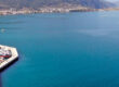
Though small and barren, the islets lay along a crucial maritime corridor linking Euboea with Thermopylae, Thessaly, and the ports of northern Greece — a corridor used by merchantmen, warships, and imperial fleets throughout antiquity.
The Maritime Frontier of the Middle Ages
During the Byzantine period (AD 4th–12th centuries), the islands themselves were uninhabited, but their surrounding channel gained military significance. The northern Euboean Gulf was a frequent route for Byzantine dromons, patrol ships tasked with safeguarding the imperial coastline from pirates, Arab raiders, and later Slavic incursions.
The islets offered limited shelter but served as points of reference — fixed markers in waters otherwise dominated by currents and shoals.
After the Fourth Crusade (AD 1204), when Euboea passed into the hands of the Lombard barons and later the Venetians, Lichadonisia began appearing on Italian and Venetian maritime charts. Medieval portolan maps mark the archipelago as a hazardous zone requiring cautious navigation, especially in winter, when storms and sudden winds funnel through the straits.
Ottoman Administration and the Struggles of the 17th–18th Centuries
With the Ottoman conquest of Euboea (AD 1470), the region entered a new phase. Lichadonisia remained uninhabited but stayed within the administrative orbit of Livadia and Egriboz (Chalkis). The straits around the islands saw increased activity:
- Pirate activity: Cretan, Maniot, and Maltese corsairs frequented the gulf, attacking Ottoman vessels. The islets, though small, were used occasionally as lookout points or temporary anchorages.
- Naval conflicts: During the long Venetian–Ottoman wars of the 17th century — especially the campaigns of Francesco Morosini — the waters around Lichadonisia witnessed skirmishes between fleets moving toward the strategic port of Stylida.
- Monastic land ownership: Surviving documents from nearby monasteries on Euboea (notably the monasteries around Istiaia and Edipsos) refer to fishing rights and grazing rights in the straits, suggesting that the use of the waters around the islets was regulated and economically significant.
The Revolutionary Period (1821–1828)
During the Greek War of Independence, the northern Euboean Gulf — lying between insurgent mainland Greece and still-Ottoman Euboea — became a contested maritime zone. The Lichades played a minor but symbolic role:
- Local captains from the Maliakos Gulf, such as those from Achinos, Agios Konstantinos, and Stylida, used the waters around Lichadonisia to intercept Ottoman supply vessels traveling between Chalkis and Thessaly.
- The islets occasionally appear in reports of skirmishes between Greek sloops and Ottoman gunboats maneuvering around the hazardous reefs.
Though they did not host battles themselves, the islands were witnesses to the intense naval chessboard of the region.
Modern Era
he modern history of Lichadonisia is shaped more by nature than by human warfare. The Earthquake of 1867 altered the shoreline of the islets. Several low-lying sections were submerged, and the shape of the archipelago changed. Contemporary travelers’ notes mention flooded pastures where shepherds once grazed goats.
Lichadonisia Today
In modern times, the islets are valued not for their strategic position but for their natural beauty — the green waters, the underwater ridges, and the feeling of an untouched Aegean miniature scattered across the gulf.