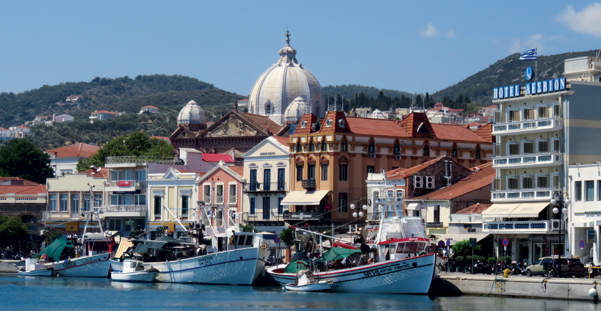
Mytilene
The city of Mytilene, the capital of the island, is spread over seven hills and is one of the oldest cities in Greece, with a history dating back to the 3rd millennium BC.
In antiquity, Mytilene was located on the easternmost coast of Lesvos on a small island that was later joined to Lesvos and extended between the northern and southern harbours. The small island of Mytilene was separated by a strait, 700 metres long and 30 metres wide, from the rest of Lesvos. The Greek word “Evripos” was often used in references to a port, similar to Chalkida. The strait allowed the passage of ships, known as trireme, with three rows of oars and six metres wide. The city extended on both sides of the Strait, the passage from one part to the other was made by marble bridges. The strait was gradually filled with rubbish and mud and filled up with embankments.
The city minted its own coins of electrum from the end of the 6th century BC until the middle of the 4th century BC.
In 429 BC, Mytilene opposed Ancient Athens and this defection was violently suppressed. The Athenian Council decided to slaughter all the men of the city and sell the women and children as slaves, but the next day the Council reversed its earlier decision. Unfortunately, it was already too late and the order that had already been given was carried out, resulting in the killing of 3,000 inhabitants.
In the Middle Ages, Mytilene was part of the Byzantine Empire, while it briefly passed to the Seljuk when it was conquered by Jahas (1085). The Byzantines, with the help of Ottoman forces, recaptured the island. Emperor John Palaiologos the 5th gave Lesbos as a dowry to the Genoese nobleman Francesco Gattiluzio the 1st when he married his sister Maria Paleologina of Lesbos. The Republic of Genoa held Lesvos until the year it was conquered by the Ottoman Sultan Mohammed II the Conqueror (1462).
The economic and social changes in the structures of the Ottoman Empire directly and indirectly affected Mytilene. Mytilene established itself as the port of the entire island in the field of transit trade, establishing channels of cooperation and communication with the major trading centres of the time, such as the ports of Asia Minor and the Black Sea, as well as Egypt and the Western Mediterranean.
After 1923 the situation changed, with the departure of the Muslims and the settlement of refugees. New districts were built and property titles were transferred. Despite the impact of the Asia Minor Catastrophe on economic and social life, commercial activities and industrial production remained thriving and profitable until 1940.
Today it is the centre of the island and a tourist attraction. It is worth walking along the cobbled street of Mytilene town and after crossing the market it is worth going uphill to the Byzantine Castle, also known as the Fortress of Mytilene. The oldest confirmed construction phase of the castle dates back to the 6th century under Justinian I. The current form of the castle is mainly due to the reconstruction of Francis Gatelouzos the 1st and his successors, from the years of their rule on the island (1355-1462), and the Ottomans afterwards (1462-1912).
The town is adorned with beautiful churches, of which the Metropolis (17th century) with its Gothic bell tower and the imposing Agios Therapos (1880) stand out. The Monastery of Saint Rafael is located just 12 km from the town in the olive grove of Karyes Thermis. Mytilene was the birthplace of great personalities such as the poets Sappho and Alcaeus the Mytilenean, as well as the mighty Pindar, one of the Seven Wise Men. Aristotle lived in Mytilene for two years (337 – 335 BC), as did his friend and successor Theophrastus, who was also born there.
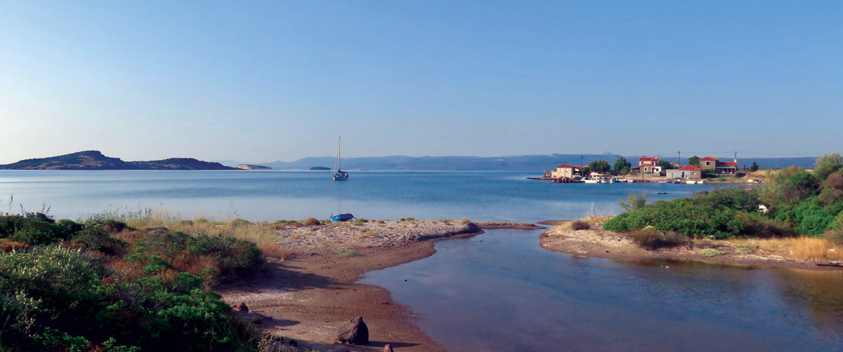
Paliós
A relatively unknown and isolated area in the north of Lesvos, with dozens of rare species of animals and plants. A special feature of the area is the scattered small natural lakes, the “louches”, as the locals call them, which do not exceed half an acre in size. The louches are about half a kilometre from the coast, and between them run small seasonal streams, such as Kamila and Avetos, which flow into beautiful beaches, creating small wetlands. Some of the rarest plant species in Greece are found here. In the louches there is also a characteristic hydrophilic vegetation with reeds and bogs as well as aquatic plants such as the water lily.
From the shore one can enjoy the view of Tokmakia, a cluster of four low islands just 1.4 km from the coast.
Very close by, at the edge of a protected bay, is the small port of Palios, which was in permanent use in the past as it is the closest point of Lesvos to the coast of Asia Minor. The few houses we see today in the settlement behind the fishing shelter were once fishermen’s huts. The house right in front of the beach was once the Customs House and trade relations with Smyrna across the road flourished. With the liberation of Lesvos from the Turks in 1912, relations continued and the port of Palios was very busy. But when Smyrna was destroyed in 1922 and the Greeks were driven off the coast of Asia Minor, trade relations ceased and the Customs House was closed.
In the area, there are also, carved on the rocks of the beach, some ancient tombs (the area is not yet exploited but there are signs to lead you there).
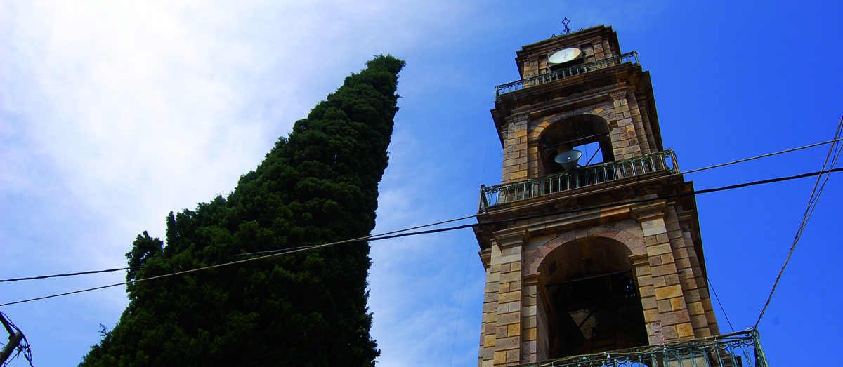
Sikaminia (Sikamnia)
The village has been classified as a traditional settlement. The houses of the village are stone-built and very beautiful. Among them is the house of Myrivilis, which is not open to visitors. There is a folklore museum in the village, which is housed in the primary school. In the museum there is also a collection of Myrivilis’ objects. The village is connected to Skala Sikaminia, where the church of Panagia Gorgona is located. The chapel is named after the characteristic fresco by an unknown folk painter depicting the Virgin Mary with a mermaid’s tail, but it is no longer in the church. In the centre of the village, above the harbour, there is a mulberry tree that is over 130 years old and because Myrivilis sat in its shadow, it is called “Myrrivilis’ Mulberry Tree”.
At Cape Korakas, near the village of Sikaminia in Lesvos and just 6 nautical miles from the Turkish coast, the lighthouse of the cape stands abandoned. It was first opened in 1863 and built by the French lighthouse company. The height of the tower is 6.5 meters. Access to the lighthouse is quite difficult from the land.
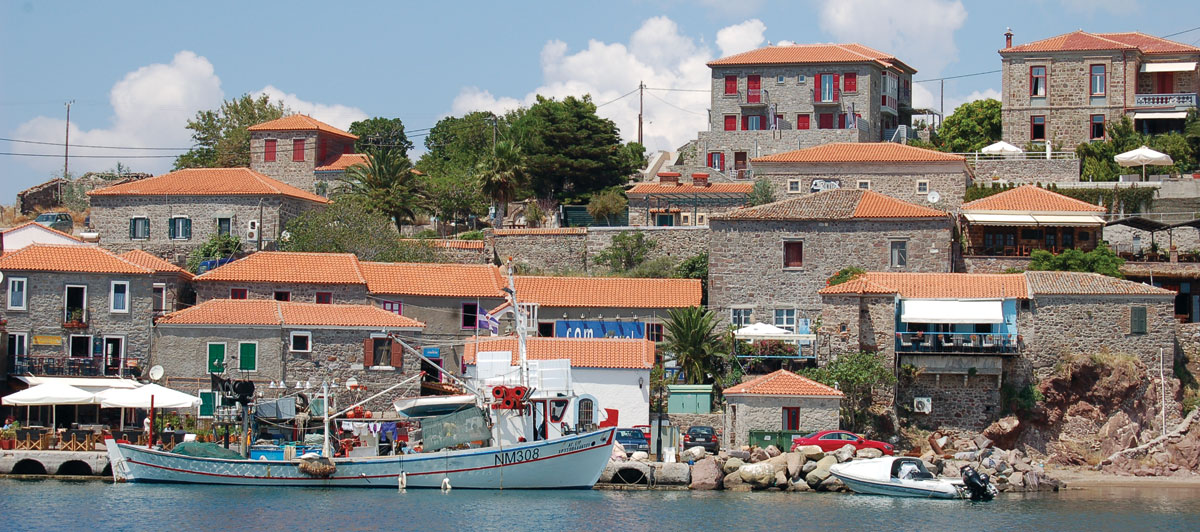
Mithymna
Mithymna (Molyvos) is a large traditional settlement of Lesvos. In ancient times it was called Mithymna, while the name Molyvos was acquired at the end of the Byzantine period. The name “Mitithimna” has pre-Hellenic (Peloponnesian) roots and was preserved throughout antiquity, until 1354 AD. Since the years of the domination of the Gatelouzian dynasty on the island, i.e. since 1355 AD, the name Molyvos prevails. Its origin probably comes from the Frankish expression “Mont d’olives” (the mountain of olive trees), whereas others claim that it comes from the abundant lead rocks in the area. The inhabitants today refer to their town by the name of Molyvos.
According to mythology, Mithymna, along with Mytilene, Antissa, Arisvi and Eresos, were children of King Makaraeus, who settled Lesbos. The specific cities of the island took their names from the children of the king, which have remained in the same places for thousands of years now and retain the same names. Mithymna married the Thessalian hero Lesvos, who also colonized the island.
In antiquity, when the Athenians suppressed the island’s apostasy, Mitymna was the only town on Lesbos that escaped the execution of the men. Mithymna and Chios were the only members in the Delos Alliance that remained self-governing and did not pay taxes. There is not much information about its history before the 4th century BC, but its existence as a polis is attested by bronze and silver coins.
The castle of Mithymna, the second largest and most important castle on Lesvos, is built on the remains of the ancient fortification. It was founded in Byzantine times in the 6th century under Emperor Justinian I. In its present form it is largely the work of the Genoese rulers, with many later additions and repairs under Ottoman rule, but also with modern repairs that are difficult to distinguish as they have been made with the same materials.
The natural beauty of Mithymna and its unique architectural character, with its colourful neoclassical buildings, have made it one of the most touristic areas of Lesvos. Τhe public buildings that are preserved in Molyvos, with their relief inscriptions, the fountain that exists in the building of the old administrative building (1898), etc. are all characteristic. The town is recognized as a traditional settlement since 1965, and was declared preserved.
Elias Venezis, a refugee from Asia Minor from Kydonia, settled in 1922. Three km east of the town is the beach of Eftalou (Efthalou), where Venezis built his summer house. There is also his grave, which according to the writer’s wish is anonymous and has only one word written on it, the word “Serenity”. In Eftalou there is a chloride radioactive spring with therapeutic properties.
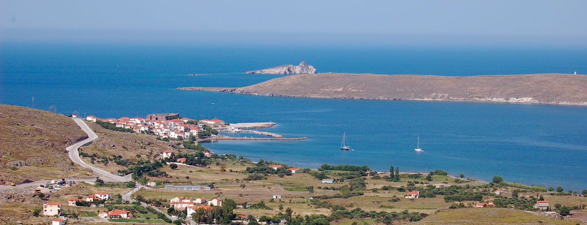
Sigri
The name Sigri probably comes from the Venetian “siguro”, which means safe, i.e. safe harbour.
The first written reference to the village is made by Strabo, but it is not known when a settlement was established in the area. After the 14th century, an organised community was found, but during the Ottoman Empire it was deserted several times due to the many attacks by pirates. It is presumed that there was some kind of Gatelouzian fortification on the same site.
During the Turkish occupation and when the Castle of Kalloni was abolished, the Castle of Sigri was founded in 1757 by the chief admiral of the Ottoman fleet, Suleiman Pasha, in order to protect the area from pirate raids and to ensure the smooth movement of goods. According to documented information, Suleiman Pasha’s initiative was also responsible for the construction of a mosque, a school, a bath, a hammam, a large aqueduct and cisterns and a pipeline carrying water from an adjacent spring.
In 1777 a company of riflemen and artillerymen was stationed at Sigri Castle, while in 1789 the castle had a garrison of 100 men and 200 cannons. The security it provided led to the settlement of the area. The first inhabitants were, according to historical sources, Turks formerly imprisoned in the fortress prison, who chose to return there with their families after their release.
In 1889 an earthquake struck western Lesvos and parts of the fortress walls collapsed. The mosque was rebuilt at the end of the 19th century. It was kept in very good condition and since 1928 it has been used as a church. The bath still exists, but is in a poor state of repair.
With the liberation in 1912 the castle ceased to exist as a Turkish camp and passed into the hands of the Allies, who used it as a supply base during World War I. Later, with the population exchange, the Turkish inhabitants left Sigri and Greek refugees from Asia Minor settled there. The refugee inhabitants had a tradition in shipping and fishing and the Sigrian merchant ships dominated the Aegean until World War II, when these small businesses did not survive. In the period 1950 – 1960 several residents emigrated to the Athens area, but also to Australia, USA and Canada.
Today Sigri receives thousands of visitors and its most interesting part is the Petrified Forest. It covers an area of 150,000 acres and spreads across the southwestern region of Lesvos. It was created 15 – 20 million years ago by intense volcanic activity. The forest consists of fossilized trunks of coniferous trees and others, such as large upright trunks of sequoias, which reach a height of 5 metres. The Petrified Forest of Lesvos has been a protected natural monument since 1985.
The beauty of Sigri is captured in the commentary of Nobel Prize-winning literature laureate Albert Camus in 1959, he wrote: “Later, when we hung out at Sigri, I was enchanted by the picturesque simplicity of the landscape, the simple people, the petrified forest and the legend of that other thing they say lies at the bottom. This is where I want to come to live and work. It is the place of the gods!”
Eresos
It is located on the southwestern side of the island, between two hills called Troulos and Lebor.
It took its name from the homonymous founder Eresos, son of the mythical king of Lesvos Makareos. More likely, however, should be considered the historical version, which comes from the verb ‘eresso’, meaning ‘to row’.
The first settlers of the place in pre-Hellenic times may have been the Pelasgians, while in the 11th to the 9th century BC, the period during which the great movements of the Greek tribes took place, ancient Eresos was built at the present coastal location of Skala Eresou by settlers from Achaean or maritime Aeolians. The ruins of the towers and large walls, in polygonal form, show that in the Archaic period the city was powerful and wealthy.
At the time the Peloponnesian War broke out, the city was constantly changing hands between the Spartans and the Athenians, depending on the circumstances.
Eresos was conquered by the Persians in 540 BC and in 377 BC it became part of the Second Athenian Alliance. Athens lost control of the city when the First Allied War broke out (357 BC – 355 BC). Apollodorus and his brothers became tyrants of the city, and remained (their descendants) until the time when Philip II of Macedonia’s generals conquered it.
The Persian general Memnon, however, attacked again in 333 BC, conquered all of Lesbos except Mytilene, and installed tyrants. Alexander the Great’s general, Hegelochus, finally captured Eresos from the Persians the following year (332 BC), brought the tyrants to Egypt for trial by Alexander the Great, but he returned them to the newly established Republic of Eresos. Tablets have been found describing the crimes of the tyrants and writing about their trial by the Republic of Eresos which resulted in their execution. In the following decades all the cities of Lesvos except Mytilene passed under the rule of the Ptolemies of Egypt.
In the period of the Roman Empire, when Octavian Augustus ascended the throne, the highest ranks of Eresos became pro-Roman. The nobility of Eresos secured the title of Roman citizen for themselves and their descendants, founded many shrines and temples in honor of the emperors, and established official festivals.
During the Byzantine period, the islands of the eastern Aegean (including Lesbos), due to the weakening of the Byzantine Empire (especially after 1200 AD), were exposed to plundering by Saracen pirates, Turks and Venetians. During that period, Eresos was plundered many times.
The resettlement of the inhabitants, from the current coastal location of Skala Eresos (Paralia Eresos) to the current location of the village, which is about four kilometres from the beach, is estimated to have taken place at the end of the 17th century and was due to the need to avoid pirate raids.
On 27 May 1821, in the sea area of Eresos, Dimitrios Papanikolis blew up a Turkish warship, the legendary “Fermantignez”. The liberation took place in 1912, the year in which Lesvos was incorporated into the national body.
Theophrastus, the well-known “father of botany”, one of the seven sages of antiquity, was born in the city (371 BC), but lived most of his life in Athens as a student of Aristotle in the Peripatetic School. The city was also probably the birthplace of Sappho, a great lyric poet of antiquity (620 BC), from a wealthy family, who praised love (and) between women and who gave birth to a universal term for homosexual love (lesbian).
The Eresos fields are dominated by the fig tree, which was once the most representative species of production and export.
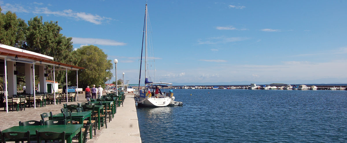
Kalloni
In the area of Kalloni, according to Herodotus, there was one of the five city-states of Lesbos at the end of the 8th and beginning of the 7th century BC. The great civilization of the region (the archaeological finds of which were found scattered over an area of more than 2,500 square meters) is believed to have been lost in the great earthquake of 231 BC.
In the area of Kalloni, monasticism developed particularly during the Byzantine period. The present-day town of Kalloni was one of the most flourishing and important Byzantine towns on Lesvos.
In 1450 the Turkish admiral Baltaoglou with a large fleet conquered the island and his men kidnapped more than 3000 people, slaughtered cattle and destroyed Kalloni. The remaining inhabitants lived in barns, that’s why the town was then called Achyron. Very few years have passed since the destruction of medieval Kalloni by Baltaoglou, and it suffered further destruction with the fall of the island by the Turks in 1462. The destruction in such a short period of time, although great, was not total, as several inhabitants of the area were rescued and remained there.
Of particular interest are the bay’s salt marshes and wetlands, which, due to the presence of a large number of rare birds, are a major attraction for ecotourism. The coastal areas of the Gulf of Kalloni have been included in the Natura 2000 network, as they are an excellent refuge and breeding ground for rare and protected bird species. The Scottish zoologist D’Arcy Thompson wrote that it was on the shores of this lagoon that Aristotle, in the 4th century BC, at the invitation of his student Theophrastus, investigated, analysed and recorded the world of animals and plants and laid the foundations for the science of biology.
The Monastery of St. Ignatius, known as the Monastery of Limonus because of the meadow (lime tree) on which it is built, is approaching five centuries of continuous operation. The museum section of the monastery is particularly important, where visitors can see relics of great cultural and historical value such as a library of printed matter with about 20,000 books from 1498 and a manuscript library with 516 manuscripts, 59 of which are in protective films. These manuscripts date from the 9th century to the present day.
At a distance of 4km, there is Skala Kalloni, the picturesque port of the region. Skala Kalloni, with its long sandy beach, is also famous for the sardine of Kalloni or “papalina” which is one of the classic Greek delicacies. In fact, every summer, on 7 July, the “Sardine Festival” is organised as part of cultural events, a three-day feast and horse races, where visitors are offered grilled sardines and ouzo, accompanied by live traditional music and dance performances.
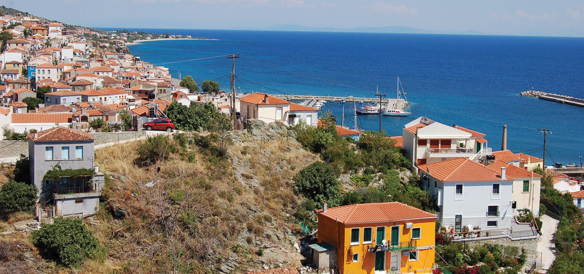
Plomari
It was built in its present location around 1842, when the fear of pirates was prevalent. It is crossed by the Seduda stream. The first name of Plomari was Potamos, because of the torrent. Megalochori, then called Plomari, was the largest agricultural – industrial centre of the region, which consisted of 18 small rural villages, referred to as ‘Plumaria’. In 1841-1843, successive major fires burnt down the old Plomari, while a few years later, in 1850, a great frost destroyed most of the olive trees of Lesvos and led to despair among the inhabitants of Plomari. On the initiative of Benjamin of Lesbos (of Megalochori origin), the inhabitants of Megalochori moved to the coastal area of today’s Plomari. Only he understood that the relocation of the Plomarians near the sea would favour the development of trade and shipping,
Plomari experienced particular growth in the 19th century, both in terms of trade and industry, until the Asia Minor Catastrophe, when it lost its ability to trade with the Asia Minor coast. The village, like the rest of Lesvos, was liberated from the Ottomans on 8 November 1912. In the mid-19th century, with the elimination of piracy, the small fishing village began to attract residents from the mountainous Megalochori .
A trademark of the settlement is the plane tree of the central square, which is said to have been planted in 1813.
It stands out for its architecture and layout, as well as for the number of old industrial buildings (olive mills, soap factories, tar sheds, etc.).
Plomari has been known as the home of ouzo and soap. The production of the famous ouzo was initially carried out in small local distilleries (called ‘rakaria’). After the end of the 19th century, distilleries were particularly developed, such as the Plomari ouzo distillery of Isidoros Arvanitis where there is an ouzo museum called ‘The World of Ouzo’. Visitors have the opportunity to learn about the history of Ouzo, to touch and smell herbs and fruits of the Lesbian land, ingredients of Plomari Ouzo, to wander around the bottling area and to watch the whole ritual of distillation, which is traditionally done in 18 small handmade copper stills. Together with the distilleries and soap factories, they have become important craftsmen with a significant production for export.
In the Municipality’s Mall (the renovated and converted former Poulia soap factory) there is a ‘Soap Museum’, where all the manufacturing paraphernalia of the product, labels of various brands of Lesbian soaps, as well as the commercial correspondence of the soap factory owners with foreign markets are exhibited. Finally, in the same area there is a permanent exhibition of photographic material on the ships of Plomari, as the area had a remarkable merchant fleet, which had a strong presence in the Aegean and the Mediterranean as far as the Black Sea.
Every summer a number of cultural events take place, the most important being the ‘Ouzo Festival’, the ‘Nautical Week’ and the ‘Veniaminia’.
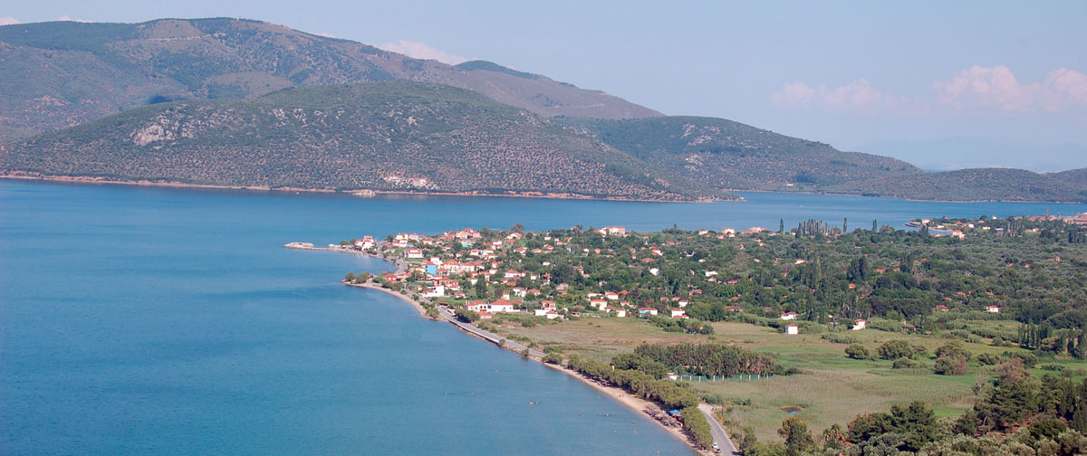
Geras
It took its name from the homonymous bay in which it was located. It consists of the villages of Pappados, Paleokipos, Mesagros, Skopelos, Plakados and Perama. 5 of the 6 villages are very close to each other, some of them are practically united. In the area at the end of the 19th century and the beginning of the 20th century, steam powered factories were inaugurated. Twelve oil mills, eight soap factories, oil factories, the “tabacario” of Surlaga, which the inhabitants considered to be the largest tannery in the Balkans, flour mills and other small and large crafts provided work for the inhabitants of the area.
In the Gulf of Gera is the ancient city of Iera, which probably gave its name to the area.
The castle of Gera is well worth a visit. The fortification is medieval but of indeterminate date, showing similarities with other ruined castles in the interior of Lesvos, such as Agiasos, Halandrokastro (built on a similar rock) etc. There are no reports from historical sources about all these fortifications. It seems that they were originally constructions of the Middle Byzantine period, probably of the dark ages (between the 7th and 9th centuries), when Saracens and other pirates began to ravage the Aegean. The majority of these castles continued to be used at least until the Genoese period of the Gatelouz (1355-1462). Some of them were also used during the Ottoman period; the castle of Gera, in particular, must not have been used during the Ottoman period as the Ottomans were not at all in favour of Christian populations staying in inaccessible and fortified places.
Of great interest are the two caves in which there are small beaches. The most impressive thing about these small caves (with the largest being the Crab Lake), is the different view of the sunset. The cave rocks form a frame, with the waters of the bay as a mirror. On these beaches there are shells instead of sand. Fresh water also gushes into the sea.


