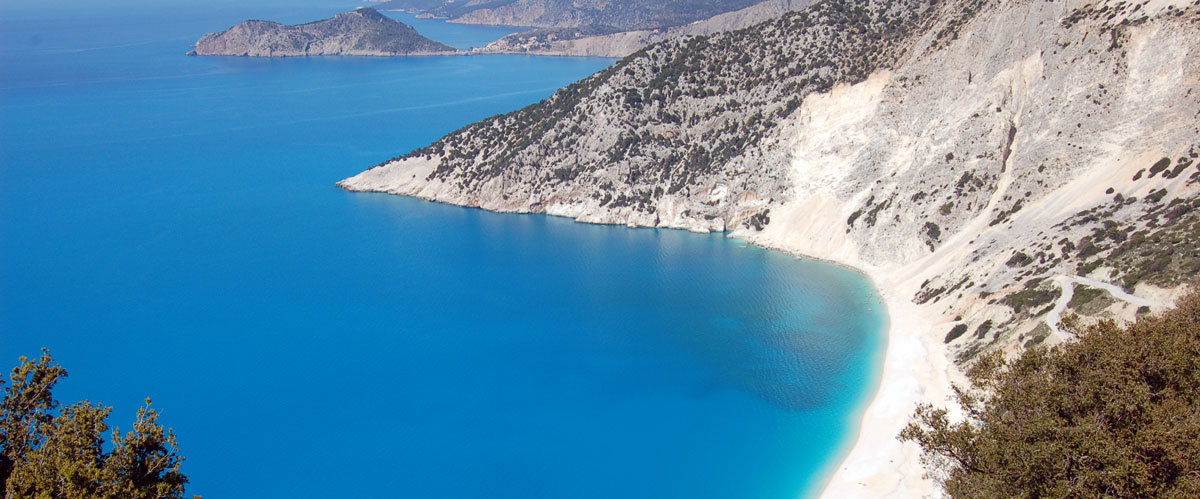
It is the largest island and the most mountainous of the islands of the Ionian Sea but the third in population, after Corfu and Zakynthos. There are two versions of the origin of the name of Kefallonia. The first, less likely, is related to the mythical hero Kefalos who helped Amphitryon from Mycenae in the war against the Televοids (also called Tombs). Amfitryonas gave the island of Sami as a gift, which is considered to be today’s island of Kefalonia. The second version claims that the name comes from the ancient inhabitants of the island who lived in the mountains, the Homeric “Kefallinians”.
The island has been inhabited since the Stone Age, according to finds in the caves of the island. The caves functioned as natural shelters for the people of that time. In the first half of the second millennium BC, (Bronze Age) according to the archaeological excavations to date, the first organized city is dated. The first known inhabitants of the island were the Leleges.
During the Mycenaean era, from the bounties revealed by the archeological ax in tombs in various areas of Kefallonia, it was concluded that the population of the area were farmers who had trade relations from the Peloponnese to the Adriatic coasts and perhaps to Syria. It is alleged that the Televoids had settled on the surrounding islands and resided on the island, or maintained a commercial base and traded closely with the islanders.
After the end of the Mycenaean era, there is a residential abandonment of the island for about a hundred years.
In the 5th century BC. Kefalonia was divided into four city-states, Krani, Sami, Pronni and Pali. These cities pursued an autonomous policy, were often rivals, and are considered one of the most powerful classical-Hellenistic citadels.
During the Roman rule the island was used as a base for military expeditions to the Ionian Sea and the eastern Mediterranean. Seaside cities such as Panormos (today’s Fiskardo) and the Sami extension were built then.
When Kefalonia ceased to belong to the Byzantine Empire, after the fall of Constantinople, it was conquered by Norman crusaders (Venetians), to end up with the Turks, who sold almost half of the island’s population as slaves. The conflicts between the Venetians and the Turks were fierce and the losses, in human lives, great.
With the treaty of Campos Formio the Ionian Islands came to France. The people of the Ionian Sea welcomed them with relief as the French promised to grant freedoms that had disappeared from Venetian rule. When the Turks returned to the island with the Russians, they restored the old aristocratic regime.
With the Treaty of Tilsit in 1807 between France and Russia, the Ionian Islands were ceded to France. Until the British with the systematic blockade of the island and the obstruction of trade took the side of the inhabitants of the island. In this way the island passed into the possession of the English.
During the British occupation, infrastructure projects were carried out, such as roads and bridges, as well as the Courthouse of Argostoli and the Lantern of Agios Theodoros.
In 1864 Kefalonia was finally united with Greece
Argostoli

It is the capital of Kefalonia since 1757 when it was decided to move the capital from the Castle of Agios Georgios to the area of Argostoli where there was a natural port. The old town was much more picturesque than today as it contained many imposing mansions and mansions, with Italian influences, Renaissance and Baroque elements. Argostoli was the second city in Greece to receive electricity.
A remarkable point in Argostoli is the ancient city of Krani, which was one of the four most powerful cities of Kefalonia in ancient times. Among the ruins are parts of the walls of the ancient city which are known as Cyclopean Walls due to their size.
The Archaeological Museum of Argostoli is a great way to see the history of the island evolve over the years.
The large stone bridge that dominates the gulf of Argostoli is the work of the Swiss, engineer by profession, military commander of Kefalonia and an officer of the English army, Charles-Philip De Bosset or as the Greek paraphrase, Devosetos. It is one kilometer long and was originally wooden. It connects the city of Argostoli with the opposite side. In the middle of the Devosetos Bridge is a pyramidal monument dedicated to its builders. Until it was built, the only exit from Argostoli to the rest of Kefalonia had to pass through the Koutavos Lagoon, which was not only time consuming but also dangerous for public health at the time, due to the diseases that lurked on the swampy shores and were transmitted mainly through mosquitoes.
One of the main attractions of Argostoli is the Light or otherwise the Lighthouse of Agioi Theodoroi. It is located just outside Argostoli and is on an artificial peninsula. This is a traditional lighthouse. It is a circular building based on twenty white Doric columns. It was built during the English occupation by Charles Napier.
Of particular interest are the Katavothres (sinks), which are a top geological phenomenon of the island. They are located at a distance of about 2 km from the capital. Seawater enters cracks near the shore and disappears. In fact, the water that enters this point follows a long route crossing underground almost the entire island. Eventually it ends and flows into the lake of Melissani, as well as to Karavomylos. This fact was revealed when Austrian geologists threw pigments at one of these entrances and then, using radioisotopes, verified the course of the “disappearing” waters. In the past, the power of water flow was used to move watermills, but today they remain unused.
One of the traditional dishes is the Kefalonian meat pie. Artichoke pie and cod pie are also made. The traditional “aliada” of Kefalonia is the fried cod with garlic. Robola Kefalonia is a white wine of Protected Designation of Origin (PDO) produced exclusively in Kefalonia. The word “robola” may come from “rembi”, to which the ancient Greeks attributed properties such as intoxication. The robola variety grows in poor soils, gravelly, limestone origin mainly in the semi-mountainous and mountainous areas of the island.
Póros
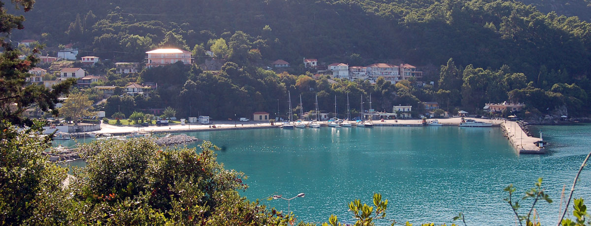
It was built after the earthquakes of 1953 and is now one of the largest villages in Kefalonia, as well as an important port.
Historically the area was the port of the ancient city-state of Pronni. At that time Pronni was one of the four most important cities of Kefalonia.
Just above the port, lies one of the most famous natural attractions of Kefalonia, the cave of Dracaena, while a few meters from the beach you will see many large rocks, which are believed to have been thrown by the Cyclops to pirates attacking the island.
The entire coastline from Skala to Poros and from Poros to Fiskardo is full of small harbors and coves and full of sea caves that are the natural environment for the rare seals Monachous-Monachous.
At the exit of the village there is the Gorge, one of the most beautiful geomorphological phenomena. It is a ravine about 800 meters long through which passes the small river Vohynas, whose waters originate from Lake Abythos.
Cultural events take place every summer in the amphitheater and the Telemachion road race in early September is a tradition of many years with participants from different countries.
Skála
It is the largest resort on the southeastern tip of Kefalonia. The modern village was built after the strong earthquake of 1953, during which the old one was completely destroyed, with 37 of its inhabitants losing their lives.
Ruins of a Roman mansion of the 3rd AD were found in Skala after excavations. The villa consists of four rooms in which intricate mosaic floors have been preserved, in good condition. The villa also had Roman baths. Near the old village is a temple of Apollo dating from the 5th century BC.
Agía Pelagía
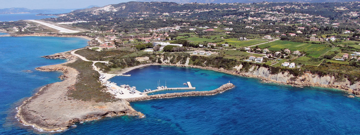
The cove of Agia Pelagia is a natural and windless port, which today has a small marina. This berth is connected to the Wars of Independence of 1821 as boats with volunteers sailed from here to the Peloponnese.
The wider area consists of many small coves with beautiful, sandy beaches.
Lixoúri

The Paliki peninsula took its name from the ancient city of Pali, which is located north of Lixouri and was one of the four large independent cities of antiquity, in the area of Paleokastro. The city of Pali took its name from King Peleas and was so powerful that it made its own currency. Today Lixouri is the second largest city in modern Kefalonia. It is crossed by a rushing torrent, which divides the city in two. Small bridges connect one side with the other and that is why the people of Lixouri call it “Picolo Paris”.
The city was a naval ally of ancient Corinth and its inhabitants were engaged in agriculture. It took part in the Persian Wars on the side of Pausanias, sending two hundred hoplites. Today’s Lixouri was founded during the Middle Ages by a residential movement of the island’s inhabitants, as a result of increasing economic strength.
When the Administration of the island was to be transferred from the fortress of Agios Georgios to Argostoli, which had just begun to be inhabited, the inhabitants of Lixouri protested and demanded that their city be recognized as the capital of Kefallonia, as the city had already developed into a prosperous one. Probably due to the lack of a safe port and the relatively longer distance from the rest of the island, the Venetians decided to make Argostoli their capital. The Lixouriotes did not accept it, as a result of which they clashed from time to time with the inhabitants of Argostoli. The culmination of this rivalry occurred when a Lixouri ship bombarded the port of Argostoli.
The earthquakes of 1953 completely destroyed Lixouri and it was built from the beginning based on a modern road plan.
South of Lixouri, in the area of Paliki, lies the beach Xi. It was named after the letter “ξ” of the Greek alphabet, as the bay where it is located resembles its shape. It is a unique beach of crimson sand and clay rocks. In the area there is another famous beach, Kounopetra. It got its name from the rock that rocked rhythmically in the sea. This phenomenon stopped after the earthquakes of 1953.
In the bay of Livadi, is the wetland Valtos – Livadi, which is one of the most important in Kefalonia. It occupies an area of 500 acres. More than 100 streams flow into its waters. Many species of birds find refuge in the area.
What characterizes Lixouri is its remarkable course in the field of arts. The first philharmonic orchestra of the island was founded in Lixouri, which is one of the oldest in
The Carnival of Lixouri gathers a lot of people every year and is the most important event of the city. The participants are also called “Colombians” because it is said that the first time the carnival took place, the locals were dressed as the sailors of the Columbus ship’s crew to represent the discovery of America
Ásos
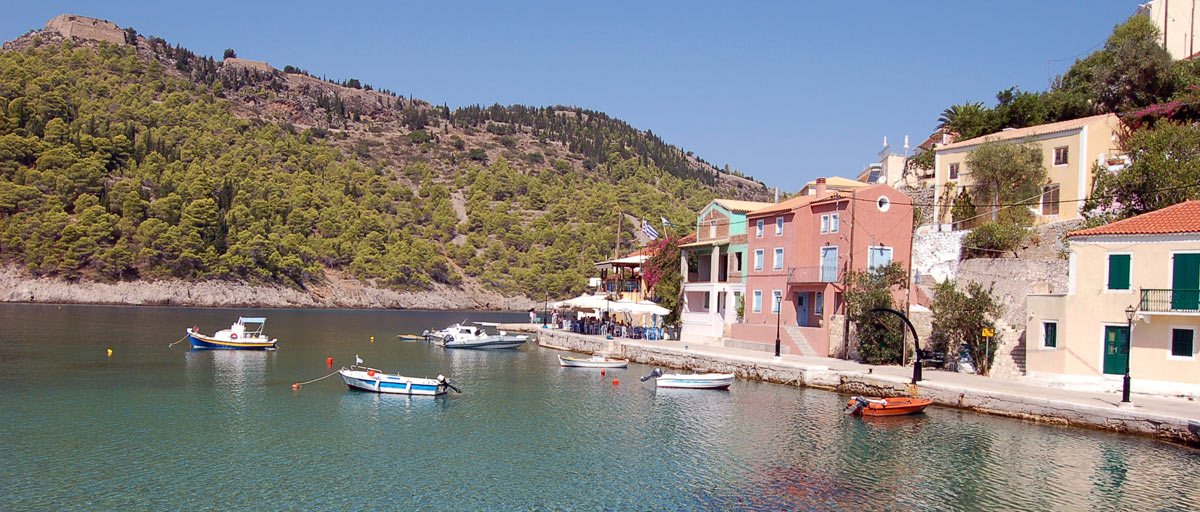
It is located on the northwest side of the island. Built amphitheatrically around the homonymous peninsula, it is one of the most picturesque villages of Kefalonia.
The peninsula of Assos is connected to the rest of the island by a narrow strip of land, on which part of the village has been built today. It has a double peak, with the highest at 154 meters, on which the Castle of Assos was built during the Venetian occupation. The castle was one of the two large castles of the time, along with that of Agios Georgios. It was built when the inhabitants of Kefalonia asked the Venetians to build another fortress because the island needed extra protection from enemy invasions.
A bay is formed on the opposite coast of the island, which hosts the sheltered port of Asos, Kefalonia. In the small port there are facilities for accommodating small boats.
The beach of Asos is small, shady and pebbly. Apart from the beach of Myrtos which is very close, there are several small and hidden beaches that are worth looking for.
The beach of Myrtos is unique, as the vegetation, the wild rocks and the cliffs, surround a large sandy beach with very fine white pebbles. The waters here have an impressive clarity. The ideal is to come as early as possible as the wind usually rises in the afternoon.
Fiskárdo
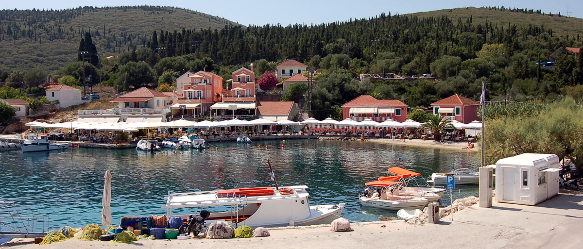
It is located at the northern end of the island, in Erisos, at the narrowest point of the canal that separates Kefalonia from Ithaca. Fiskardo was founded during Roman rule and its ancient name was “Panormos”. Panormos is generally characterized as the bay, or port that provides good security regardless of the weather conditions.
Because some strong Roman families appreciated the mild climate of the island, they chose this area to build mansions, the remains of which were discovered in our times. Similar remains were also found in other areas such as Sami. The plumbing, the mosaic floors and the architectural composition testify to the prosperity of these families.
floors and the architectural composition testify to the prosperity of these families. Today’s Fiskardo has been described as a protected settlement, as it is one of the few in Kefalonia that was not leveled by the catastrophic earthquakes of 1953. It was named after the Norman conqueror Roberto Guiscardo, lord of Calabria in Lower Italy, who although defeated the united in Venetians and Byzantines did not manage to occupy the island.
The reference points of the village are the lighthouses at the cape. A “new” and an “old”, the two stone lighthouses are built on the edge of the settlement, on the northwest coast of Kefalonia, very close to each other.
The poet Nikos Kavvadias was born in Fiskardo. His paternal home where he spent his holidays as a child survives to this day.
Agía Efimia
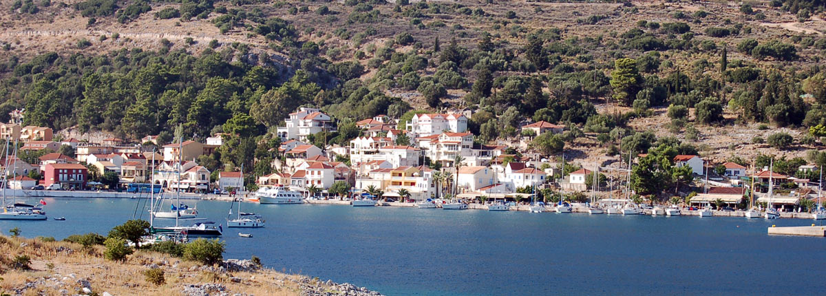
Agia Efimia is one of the most beautiful coastal villages of Kefalonia. It is the picturesque port and the centre of the Municipal Unit of Pylaros. Its name comes from the word “pyloros” which means “guard of the gate”. Archaeologists have found traces of an ancient mansion and mosaics from the Roman period, indicating that the Romans had invested in the area, perhaps because it was considered the passage or gateway to the northern part of the island.
On the 11th of July every summer, on the day of the celebration, but also on the eve, a big festival takes place in Agia Efimia with pilgrims and visitors from all over Kefalonia.
Within walking distance from Agia Efimia is the monastery of Themata. The visitor can see the old wood-carved iconostasis of the Monastery of Themes, but also the icon of the Virgin Mary. The area hosts animals such as goats, sheep, deer, llamas, horses, ostriches, which children can fool around and feed.
Sámi
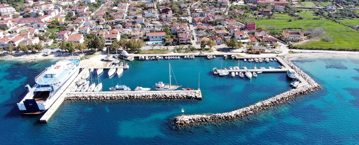
Sami is located on the northeast coast of Kefalonia and hosts the port of the island that connects it with Ithaca and the opposite coast of Etoloakarnania.
The story of Sami begins with Homer, who mentions it as part of the kingdom of the leader of the Kefallinians, Odysseus. The Kefallinians took part in the Trojan War. Vigla hill may have been the Mycenaean citadel, as evidenced by the surviving parts of the important vertical citadel of Sami. During the 2nd century BC. Sami attracted the interest of the Romans due to its strategic position so they campaigned in order to occupy the island. Of the cities of Kefalonia, only Sami decided to change her attitude and resist strongly. The siege lasted 4 months and the city finally surrendered. Several archaeological finds testify to intense construction activity. The pirate bonuses during the 5th and 6th century AD. and devastating earthquakes, in combination with other factors, contributed to the gradual decline and eventual abandonment of the city.
Among the sights of the area are the archeological sites of Sami. On the hill above the city lie the ruins of the ancient castle (Paleokastro) and the ancient Acropolis of Kyatis, where the monastery of Agios Fanentas is located.
Around Sami are some of the most important sights of Kefalonia such as the Melissani Lake Cave and the Drogarati Cave. 17 cave and abyss sites have been recorded, which is unique to Greece.
The cave of Melissani is located 2 km northwest of Sami. It is a precipice lagoon. It is 3.5 km long and the natural entrance of the cave is vertical measuring 40 x 50 length and was created by the fall of a part of the roof. An artificial entrance with stairs and a long underground corridor allows a visit to the cave. The lake is located 20 meters below the ground and its water depth ranges from 10 meters to 30 meters. The great value of the cave lies in the way it was created, that is, the water enters the limestone rocks with a natural consequence of their erosion.
The entrance of Drogaratis cave is located in Haliotata, 3 km from Sami. Its depth reaches 60 meters below ground level. Stalactites and stalagmites more than a hundred million years old compose the impressive landscape. It is the only cave in Greece where concerts are organized for over 500 people.


